
Al Jazeera leverages virtual map environment to look back at roots of Ukraine-Russia conflict
Weekly insights on the technology, production and business decisions shaping media and broadcast. Free to access. Independent coverage. Unsubscribe anytime.
Al Jazeera produced a virtual explainer centered around a map that explains the context, history, geography and major players in the Ukraine-Russia crisis.
The segment started by using a “video on video” shot to capture one of the video walls on Set 2 inside the network’s Studio 5 in Doha, Qatar.
It then transitions to a fully virtual view with the presenter standing inside of a large hanger-like 3D environment that includes a seemingly freestanding glass-like panel that serves to frame the view.
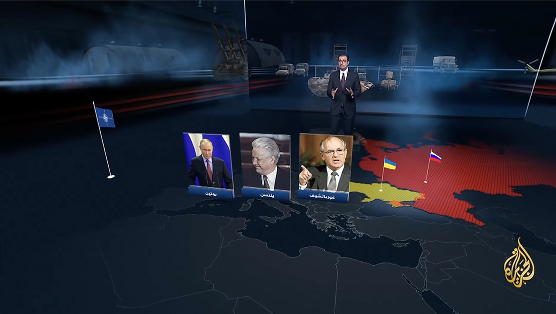
The camera pulls back to reveal a map on the floor of the space with 3D models of military vehicles in the background.
Meanwhile, small flags sprout up as the presenter explains how various countries’ histories intertwine with the build up of the modern day conflict. The NATO flag also appears but is placed out in the Atlantic Ocean to illustrate that it represents multiple North American and European countries.
The scene also includes 3D numbers that label the year of key past events. On the map itself, the countries being discussed are highlighted with solids and patterns.
As the segment continues, additional flags pop up and countries become highlighted, with additional floating panels used to showcase photos of key figures and, in one case, a quote.


tags
Al Jazeera, Explainers, Ukraine-Russia Crisis 2022, virtual environments
categories
Augmented Reality, Virtual Production and Virtual Sets, Broadcast Design, Broadcast Industry News, Featured